Tamadite Beach Trail: The wildest coast in Anaga!

Sendero de la Playa de Tamadite
Tamadite Beach Trail - Roque Páez, over the Afur Farmhouse

“Discover the wonderful trails of Tenerife with our expert hiker Francisco Fariña

Tenerife Trails: Tamadite Beach Trail

DIFFICULTY: Easy.
TIME: 1-2 hours.
KILOMETERS: 3 kms.

Index

The Tamadite Beach Trail is a route that runs along the slopes of the Barranco de Afur, one of the wildest environments in the Anaga Massif, its course carries a permanent stream of water that forms various pools and waterfalls along its course; When you arrive at the beach you will enjoy an unparalleled natural environment!

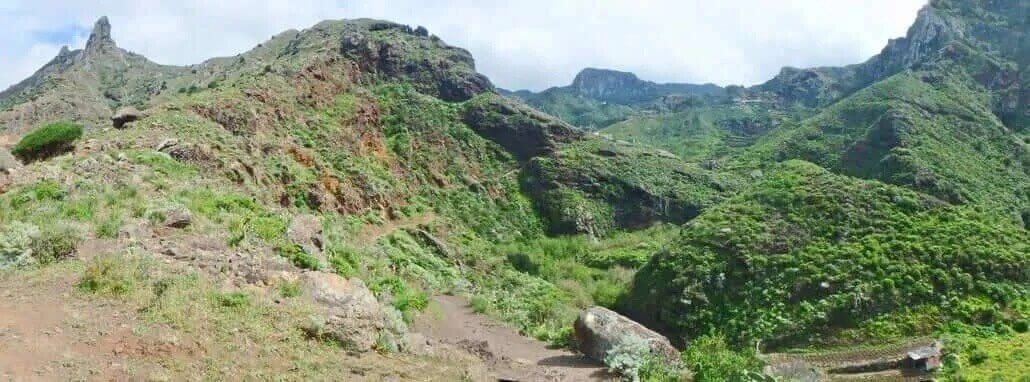
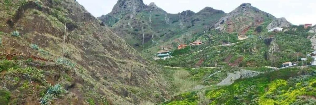
The Tamadite Beach Trail begins in the picturesque square where the Hermitage of San Pedro is located, in the Caserío de Afur, located under the imposing Roque Páez (586 m.). Rocky piton that stands out from others that surround the Afur Valley, formed by high and steep slopes where we can see the Roque Negro (741 m.), the Roque del Fraile (710 m.) and the Lomo del Viso with the Roque de Taborno (706 m.).

Before leaving, it is necessary to go to the only inn in the village and chat with its friendly owner, who will tell us curious stories about the town. Let’s interact with the locals!

From the square we will start the journey following the signs of the approved path PR-TF-8 (Tamadite Beach Path) that heads through the area known as Los Huertos, between some isolated houses and several crop gardens, until a sharp turn to the right makes us go along a path with an earthy surface to cross the Lomo Centeno Track and go towards the bed of the Barranco de Afur.

This path runs along the margin of the same ravine and descends gently bordering its own riverbed, which, by the way, is invaded by a leafy reedbed.

We enter the slopes of the Afur Ravine

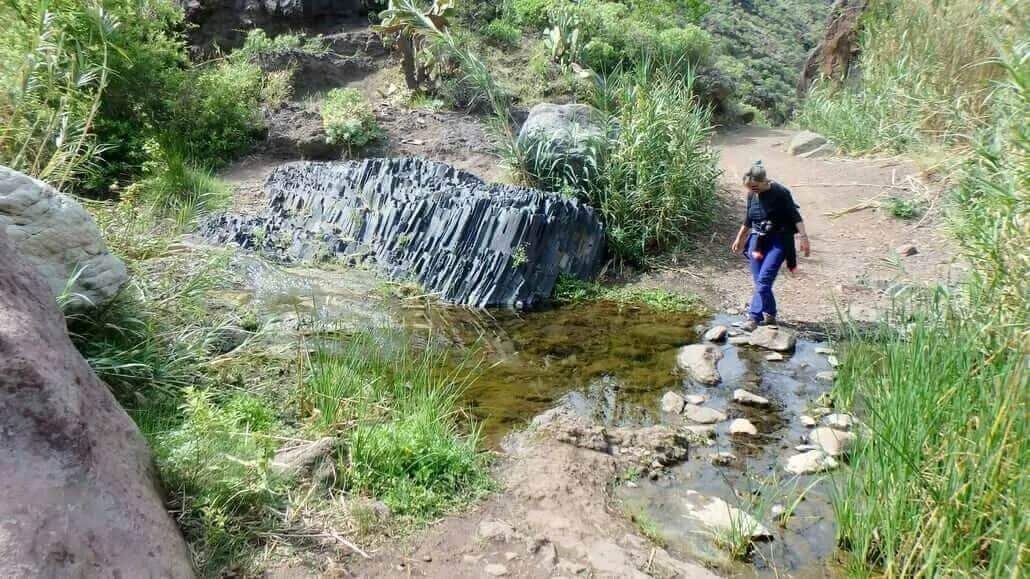
Between Vinagreras, and some Piteras, which coexist perfectly with the native flora made up of Verodes, Tabaibas and Matorriscos, we progress next to a rocky wall of curious volcanic formations and further on, next to a large rock. The Tamadite Beach Path takes a sharp turn to the right to continue flattening, always under the imposing mountain range that forms one of the slopes of the Barranco de Afur.

Tamadite Beach Trail
Descent along the Tamadite Beach Trail

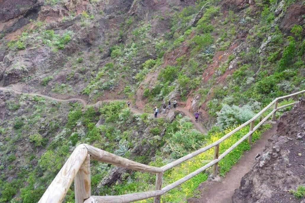
Further on, through the Los Pasos area, a wooden fence protects part of the path and climbs a little through some steps carved into the surface. Then it suddenly descends staggered through a rather degraded and irregular section, having to advance very carefully because the slope is quite pronounced.

It then continues descending more gently under Las Laderas del Charquillo, and then along a compact and flat surface until it reaches the Lomo del Descargadero.

From here begins a rather slippery and winding descent that borders the bed of the Barranco de Miguel. It has some staggered sections and protected by a wooden fence. From the path we can see the majestic image of Roque Páez, which stands at the head of the ravine.

Tamadite Beach Trail
General view of the Afur Valley; in the background Roque Negro

A Stone Dam Cut by a Cascade

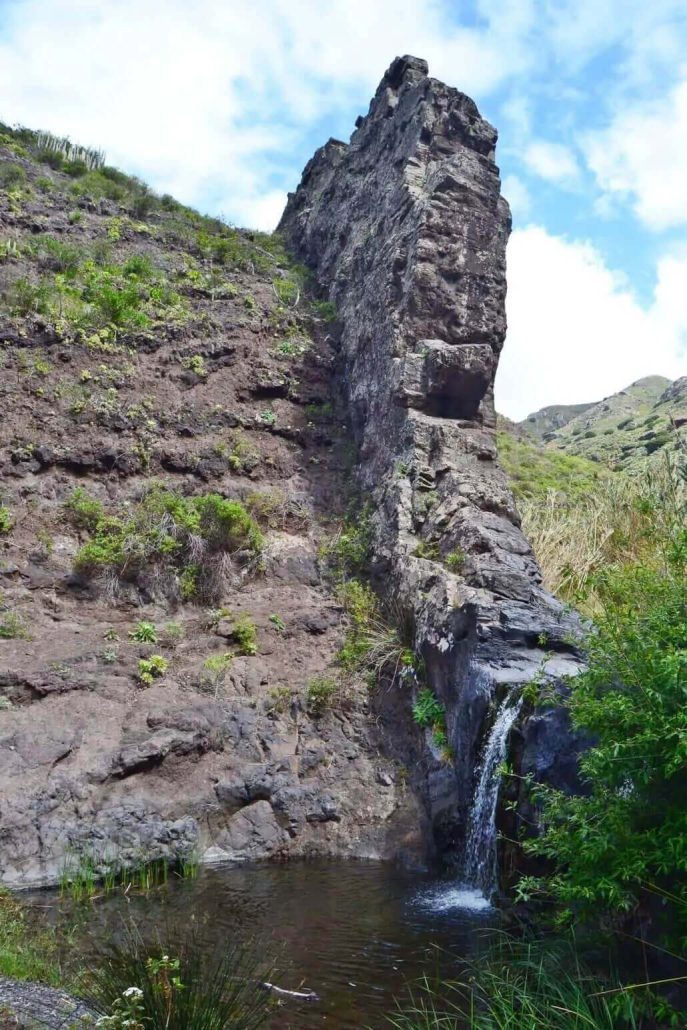
We will arrive at the basin of the Barranco de Afur, which converges with the Barranco de Miguel, where a stream of water welcomes us. Immediately the Tamadite Beach Path goes back a few moments and we will be in the most emblematic place of the route: A waterfall several meters high that flows under a rocky that cuts perpendicularly the bed of the ravine and that drains into a pool between Canarian Willows, common on the banks of the streams of the Anaga Massif.

Tamadite Beach Trail
Crossing the bed of the Barranco de Afur

After crossing the ravine, we will climb some stone steps through another section protected by a wooden handrail and as we gain altitude, the fantastic landscape of the Afur Valley opens up to us, highlighting at the top the Roque Negro with its 741 meters above sea level.

At the end of the climb, the path flattens out under El Cerrillar and a few meters later it descends sharply again through a very stony terrain, which runs under a slope covered with a leafy Cardonal – Tabaibal, a characteristic ecosystem of the area.

Tamadite Beach Trail
Waterfall at the foot of a rocky dam

A sharp turn in the direction of the path leaves us in the area of the Cruz del Draguito, a large space where we will enjoy the majestic image of a huge rocky wall where the tortuous climb zigzags towards the Caserío de Taborno along the Camino de Palos Hincados.

At the base of this mountain there is a small house surrounded by some orchards and on the surrounding cliffs, there is a notable immense and at the same time dispersed population of Cardones and Tabaibas. Don’t hesitate, stop and enjoy!

We arrive at the beach, Costa Salvaje

The route continues along the Tamadite Beach Path in the direction of this farm and ignores the Palos Hincados Path. It then passes near the walls of the orchards and descends again bordering the ravine over a pool of water that is fed by a waterfall, it is the so-called Charco de la Pasada.

It is curious, according to popular legends, that some specimens of Eels lived in this pool, a species of foreign origin that has its origin in the sea and happens to live in the pools and pools of fresh water and that are currently practically extinct on the islands.

In the past, the Barranco de Afur, before depleting its water flow, was home to these animal species and the ancient inhabitants fished them, either to feed, to keep them in aquariums, or also to use them as natural remedies against some common ailment. In this pool, if the conditions are favorable, we can take a relaxing bath!

Leaving this pool behind, we will flow further on through a rocky area, into the bed of the ravine itself, which in this area widens between its slopes, and we will continue next to the stream along a path that is not very marked and with a stony surface; we will see how to the right ascends a stony path that ascends the Lomo de Tamadite, at the base of Roque Marrubial (487 m.) and that heads along the PR-TF-8 towards Taganana.
Tamadite Beach Trail
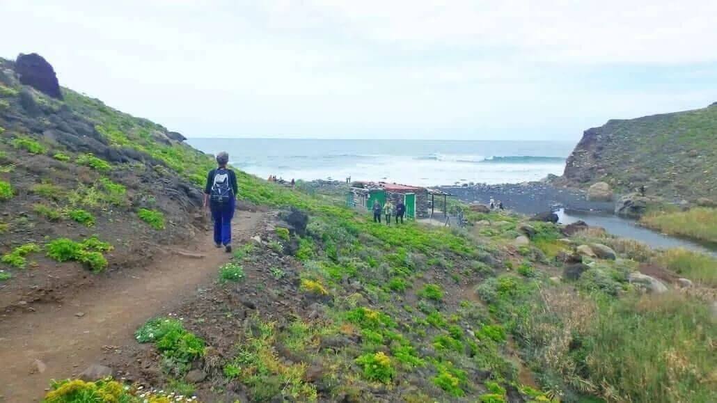
Arriving at Tamadite Beach

We ignore this path and continue a few meters downstream until we reach Tamadite Beach, a small cove of volcanic black sand and large pebbles (pebbles), which extends from Punta de Tamadite, under the rocky slopes of Roque Marrubial (487 m.), to the Lomo de las Pesquerías, rocky slopes that plunge vertically towards the sea. plagued by Cardones and Tabaibas.

Don’t swim on the beach, but enjoy the magical surroundings!

If you want to know other trails on the island, visit the website of our route expert Francisco Fariña.
https://franciscoadanfarina.blogspot.com/
Facebook: Francisco A. Fariña Encinoso